Wednesday, October 21, 2009

Track of Entire Trip

This image displays the actual GPS track of the entire trip:

This is the actual GPS recorded elevation profile of the entire trip:
Total Distance Traveled: 8902
States Visited: 21 (WA, OR, ID, UT, WY, CO, KS, MO, IL, KY, WV, VA, NC, TN, AL, MS, AR, TX, NM, NV, CA)

Tuesday, October 20, 2009

Day 47 - Tuesday, Oct. 20 - The Very Best Road

After 8902 miles in 47 days (164 hours in the saddle of the motorcycle), I found the most beautiful road: my driveway:

It's great to be home.

Monday, October 19, 2009

Day 46 - Rain and Cold: California Prepares Me For the Northwest

First -- a warm family connection before leaving Reno. After that, the route out of Reno was the most cold and wet I've experienced on the entire trip.

Little did I know that when I added the Google "Latitudes" feature to my blog site that it would be more than just entertaining to readers. Yesterday, when a first cousin observed that I was in Reno, she left a voice mail message which reminded me that one of her sons, whom I had never met, lived there. I reached him at home and we arranged to meet at his nearby work location this morning. It was fun to connect with him not only because he is also an avid motorcyclist not too many years younger than I, but also because he reminded me alot of his grandfather, a favorite Uncle of mine who had inspired me with his work as a crop duster pilot and his sailing adventures. I think I was under 10 when this Uncle completed what I now realize must have been one of his bucket list trips -- sailing his 30-something foot sailboat from California to Hawaii.

It was great to start the day with this warm family connection -- because the rest of the day stayed a bone-chilling 39 to 41 degrees as I rode in the most intense rain I've ridden in during the previous 45 days on this trip. Thankfully my new rainsuit worked perfectly (again) and adding a second pair of socks and some extra layers kept me somewhat comfortable. The route was very straight (395 north through eastern California), traffic was not overwhelming and the rain was not constant. In fact at one point I had blue skies (though it wasn't warm) for part of the ride -- but that didn't stay long.

As planned, I put in about 275 miles and ended the day at a pre-arranged condo in Klammath Falls, Oregon -- now within about 320 miles from home -- tomorrow's destination. I'm looking forward to it!

Sunday, October 18, 2009

Day 45 - The Biggest Little City

The first 225 miles of the "Loneliest Road: (Route 50) yesterday were enough for me -- but this morning I was "treated" to another 230 miles as I traveled westbound from Eureka, Nevada. It was more of the same. I finally left Route 50 on Route 341 through Virginia City on my way into Reno, Nevada. Route 341 was delightful as it is a spectacularly curvy and beautiful descent into Reno where the few cars I encountered immediately moved out of the way. I could tell from the number of motorcycles sitting along the street in the historic Virginia City on this Sunday that this is a popular local ride destination.

The condo I had arranged was just 3 blocks from the main street of Reno, so I enjoyed a leisurely stroll,
took in one of the buffet troughs and got a suitable amount of entertainment from losing about $15 in the machines. Later in the evening I was treated to some company from home -- I connected up with a couple who are great friends from my hometown who coincidentally happened to be traveling through Reno to a business conference in the Lake Tahoe area. The connection rendered the "Loneliest Road" here just a fading memory.

Random Thoughts - Why I Pass You

For most of the trip I've had this subject on my mind as I ride -- particularly when I get stuck behind some driver. I'm hoping that for those of you who don't ride motorcycles, I might provide a little insight into the problem -- so that you might be inspired to be a more thoughtful driver next time a motorcyclist ends up behind you.

I try to legally pass EVERY car/truck that gets in front of me -- and here are some of the reasons why:

10. I have seen a large number of cars/trucks have either one or both brake lights and turn signals that don't work. It's no fun and dangerous to try to figure out when you are braking or turning. When is the last time you checked your rear brake/turn signal lights?

9. I have seen a large number of cars/trucks with unsecured loads that are a bump away from flying into a motorcyclist's face, or worse, under a tire at 60 mph.

8. I have seen a huge number of car/truck drivers who are preoccupied with cell phone conversations or texting. I even saw one woman on this trip with a minicomputer perched between her belly and the steering wheel. [Remember, I sit high where I have excellent view into most all cars -- and I have great fun when I've found myself next to a driver who is on a cell phone, dialing or texting, by blasting my horn. It's fun to watch the offending driver's instantly come out of their distraction, trying to figure out what's going wrong.]

7. For optimum safe riding, I must enter each corner at a speed where I can continue to accelerate through the entire corner. Car drivers and many untrained/unskilled motorcyclists slow in the corners.

6. My life depends on my ability to correctly assess road condition and avoid road debris. When following a car/truck, my sight distance for road condition is severly limited. That piece of tire or metal that might just cause your car to bump, can kill me.

5. I have seen some car/truck drivers with pets sitting in their laps and therefore obstructing their steering while they drive. I'm giving 100% attention to driving my motorcycle, my life depends on it -- I wish you would drive the same way.

4. I have had several car/truck drivers spray their windshield washing fluid when I'm behind them. The drivers do not realize how much of the spray overshoots their window and hits my glasses or face shield.

3. My safety is great enhanced when I have nothing blocking my vision in the path of travel.

2. The wind disturbance created by the car/truck traveling in front of a me is significant, creating a buffeting of my head/helmet.

1. Because I can. Just kidding, of course -- but it is true. I've only ever been in one car that has acceleration approaching that of a motorcycle (Dave!).

Please note as well that none of the reasons is because I need to travel faster. In fact, often times the car ahead of me is traveling an acceptable speed -- and I'll still pass for all the reasons stated above. It is also true, though, that I will NEVER slow traffic behind me -- for even I will move or signal to the right if I perceive a vehicle behind me is moving faster than I am.

Generally, I can usually immediately tell if the car/truck driver ahead of me is either a motorcyclist or educated in motorcycling as those driver's will signal that they are moving to the right to allow me to pass immediately upon seeing me in their rearview mirror. I great appreciate their thoughtfulness -- which can be executed at any time, including when their is a double yellow that would otherwise prohibit my passing. If the leading car/truck just gives a brief signal, it allows me the opportunity to explain that my passing on a double yellow is permissible because the leading car/truck was signaling that they were either turning right or pulling over to allow me to pass.

I hope you'll think of some of these reasons next time you see a motorcyclist in your rear view mirror.

Saturday, October 17, 2009

Day 44 - "A Whole Lotta Nothing That Way"

I'll definitely be coming back to Utah both with Deb in a car and hopefully someday again on a motorcycle -- another bucket list item. But today it was time to move on. I was up early and readied the bike while chatting with another Goldwing rider who had stayed at the same motel.

I had plotted a route over a nearby 10,600 "Brian's Head" peak (the local ski resort) to the town of Parawon and got started at my usual 8-ish. I was well underway on the route when I checked the temperature. It was only 30 degrees and I still had 3000 or more feet of ascent to the summit. Not certain if the roadway would have ice, I debated with myself about returning to motel until later in the morning -- but chose, instead, to just slow my pace and continue the ascent. It made for a less fun ride (the "pucker factor" was pretty intense as it was impossible to determine whether the many tar snakes might have a frozen surface). However, in short order I noticed a lakeside country store and decided to kill about an hour there with a cup of coffee to allow time for the sun to warm the roadway.

Some of you may enjoy comparing this photo 
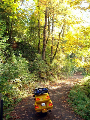
that I took just before stopping at the country store with the Google "Street View" of the same spot that you can see my clicking here. In fact, you can actually take a virtual "ride" of the entire route (and lots of other routes I've been on) using the "Street View." But like most things -- pictures may tell 1000 words but there is nothing like the personal experience.

Near the summit, I took this photo from one of the overlooks -- definitely not a Kansas "overlook."
After exiting the town of Parawon, the landscape changed dramatically to a very flat farming valley as I proceeded on State Hwy 21. I searched the first town I came to, Minersville, for a meal stop but found nothing and almost bypassed the only restaurant in the second town, Milford, because the parking lot was empty (it obviously didn't meet my "trucks" standard). But I was hungry and needed a restroom, so I pulled in. It turned out it was a lucky break to have stopped because the breakfast was delicious and the staff friendly. As I was the leaving, a cashier with smiling eyes cautioned me, when I explained my direction of travel, that "there's a whole lotta nothing that way." Indeed she was right, immediately upon leaving the restaurant I saw a sign that said "next services, 83 miles" and I was back onto Texas-like straight roads as I headed to Route 50, the so-called "Loneliest Road in America."

About 90 miles later, there was a Visitor's Center for the Great Basin National Park located where State Highway 21 meets Route 50. I briefly stopped there and enjoyed some interesting conversations with other visitors. I haven't decided whether it the fact that I'm traveling by motorcycle or just the fact that I'm alone that people seemed more willing to engage in conversation. Perhaps a little of both. I decided to forgo the one hour detour it would take to travel to the actual park and continued on the "Loneliest Road."

The "Loneliest Road" is rightfully named as there virtually no traffic and, but for a very few towns, nearly no houses or structures of any kind in sight. Just miles and miles a straight roads on desert landscape. Now I must explain that the road was NOT uninteresting nor lacking in beauty -- as it felt like I was traveling through a continuous series of large craters. But the straight riding does get monotonous regardless of the beauty of the scenery. By the time I had gone 225 miles through this "whole lotta nothing," I was in a small, run-down town of Eureka, Nevada where I found an acceptable motel for the night.

Friday, October 16, 2009

Day 43 - Oh What A Day!!!

Idaho Sawtooth, Colorado Rockies, West Virginia & Virginia Mountains, Blue Ridge Parkway, Smoky Mountain's "Tail" and Skyway are yesterday's loves -- today I fell in love with roads in Utah.
Click here for larger image

Just outside the ho-hum town of Blanding, UT, I picked up Highway 95 (known as the Bicentennial Highway) through the Glen Canyon National Recreation Area expecting it to be just another "scenic" desert pathway. I couldn't have been more wrong. Immediately I was on wonderfully curvy canyons between dramatic cliffs and crevices that evidenced the power of water over millions of years. Pictures will never do justice to the magnitude of the beauty that surrounded me on this route but it gave the feeling that I was in a video game on a roadway near the bottom of the Grand Canyon.

Several times I stopped the bike to take in the vistas -- and the only sounds were a few birds in the otherwise silence of these red-rock canyons being illuminated by the dawning sun against a bright blue sky. The ride had a truly magical feeling with a perfect mix of exciting curves and enjoyable straight-a-ways. In the 133 miles (about 3 hours with my stops) to Hanksville, I did not see one vehicle going the same direction I was going -- and only a few traveling the other way.

The route crosses the Colorado River at the point that the man-made Lake Powell begins, and since I had never seen Lake Powell before, it too was a treat of beauty along the way.

After a fun, conversation filled breakfast in Hanksville, I turned first on Highway 24 and then Highway 12 which collectively National Geographic calls "Scenic Byway 12." First off -- the route needs a better name like "Tail of the Rattler" or some such catchy slogan. But what may be lacking in its name is definitely made up for in its beauty. I've included a map of the entire route(above), but this part of the route traverses the Capitol Reef National Park, the Dixie National Forest, the Grand Staircase-Escalante National Monument and Bryce Canyon National Park. National Geographic gets it right when it says "this highway snakes along narrow ridgetops, carves through red-rock canyons...ascends 11,000 foot Boulder Mountain for breathtaking views."

Again I was treated to a general absence of other vehicles and landscape that included the bright yellows that can be seen in earlier pictures I've posted. I could go on and on -- but you get the picture -- I loved this route and, as previously mentioned, believe it to be the most fantastic of the entire journey. Is it just because it is the most recent beautiful ride? Perhaps. Is it because I caught it on a day when motorhomes and other tourists didn't plug the route? Certainly. Is it because it was a crisp October day with the leaves in the peak of their brilliant yellows? Of course. All the right reasons came together today and made for a wonderful day. My only disappointments would be (1) that Deb wasn't along to share it with and (2) Utah uses tar stripes to patch it's roadways and these tar "snakes" can be treacherously slippery to motorcycles -- keeping me slightly more tentative/cautious than usual. The first one is easily fixed -- I'm already thinking about when I can bring Deb back. As for the tar -- well, maybe it's a good thing that something slowed me down a little.

I guess I should also mention that I'm aware that I didn't even get to see ALL the scenic beauty this area of Utah has to offer in that I didn't even make it to the Moab area that includes the Arches and Canyonlands National Parks. Of course I'm adding those roads to the bucket list as well!

I treated myself to a nice motel in Panguitch, UT and briefly thought about doing the same route in reverse the next day -- but, alas, I'm starting to feel the common homing instinct that often sets in towards the end of a trip. John Steinbeck's words (that I quoted at the beginning of this blog) are even more true now: "... my warm bed and comfortable house grew increasingly desireable and my dear wife incalculably precious..."

Tomorrow my planned route includes Nevada's "The Loneliest Road in America." We'll see whether that road lives up to its name -- but for now I'm renaming today's "Scenic Byway 12" as the "Best Ride Of This Trip."
This is the only picture I'm going to post -- just as token reminder of the day. None that I took truly show magnificence of the day's ride.

Day 42 (Thu., Oct 15) - Great Start - Crappy Finish

Two nights in Santa Fe were not enough -- but it was time to get on the road again and the first 100 miles of the day were spectacular as I took Highway 4 through the Bandelier National Monument and close by to Los Alamos (the "birthplace" of the atomic bomb), through the Caldera National Preserve and the Santa Fe National Forest. The temperature was a crisp 54 degrees with beautiful blue sky as I ascended the 8,800 foot roadway with not one vehicle slowing my ride.

Going Up
Coming Down

However, the next 200 miles were back to fairly straight, high speed travel through unremarkable desert landscape and the strip-mall looking town of Farmington which had been my initial destination for the day. I arrived there around 1:30pm and instantly decided to keep moving to the Four Corners Monument -- at the intersection of the states of NM, AZ, UT and CO.

The "Monument" is on Navajo controlled land for which the Navajo's charge a $3 entry fee to view a brass marker surrounded by what looks like a dilapitated flea-market of T-shirt and trinket vendors. I wasn't impressed -- but did find some humor of my seeing this microeconomic example of unregulated capitalism on the same day that we learned of bigger AIG bonuses. And, I learn tonight from my reading on the internet, the "monument" isn't even in the right spot anymore based on current technology. A mile here, two miles there -- who really cares -- I doubt anyone including the Navajo toll collectors and vendors really cares where in this flat desert landscape the true "corner" exists.
Admittedly, my bleak assessment of this spot may be clouded by the fact that I almost dumped my bike there as I was leaving -- just crawling along in the thick gravel. It was one of the moments that passes in a flash but haunts every memory of it. As much as I would like to forget this very forgettable sightseeing gimmick, I will forever remember the Four Points Monument as where I almost dumped my bike.

I finished off the day with a bunch more straight and ended up in Blanding, UT -- which was about as interesting as Farmington. I took a chance on a $25 a night motel room, the cheapest of my trip, and got about what I paid for. Good news is that the sheets and towels were clean, and I know I didn't bother my neighbor because I could hear him snoring.

Little did I know, as I drifted off to sleep, that Blanding would turn out to be a most excellent place to begin a day long ride that will be a contender for best ride of the trip -- and among the top rides of my life. Stayed tuned.

Wednesday, October 14, 2009

Update: Rider Adds Our Meeting to His Blog

Some of you may find it interesting to see what my friend/fellow rider/blogger from Brazil added to his blog about our meeting yesterday. Select "Day 9" after going to this link. He also included the picture of both of us that I mentioned yesterday.

Just reading his blog posting for today (his "Day 10") -- he got a unrepairable flat tire from road debris. I definitely feel for him.

Day 41 - 151 Miles Just For Fun and Beauty

I had already planned to stay in Santa Fe a 2nd night both because of the many nearby motorcycle roads and the lovely weather. The pictures tell the story better than words -- taken on a 151 circular route over the "High Road to Taos" -- isolated mountain towns surrounded by 13,000 foot mountain peaks in the peak of fall colors.


Yes, those are fly fisherman in the river in that last photo.

During the ride, the keylock to one of the storage pockets (where I store my sunglasses) failed to open the pocket. This pocket had been removed yesterday when the Honda parts guy replaced my headlight so it was a pretty good guess that the cable from the key to the latch had not been refastened correctly. Thanks to some excellent guidance on youtube.com on exactly how to fix the problem, I got it fixed easily after the ride though it did take some disassembly of plastic and parts -- and a borrowed piece of wire from a local maintenance guy.

A great, relaxing and easy day in superb weather and tomorrow looks like more of the same as I head for the northwest corner of New Mexico to the "Four Corners Monument" where NM, AZ, UT and CO all meet.

Tuesday, October 13, 2009

Day 40 - First Honda Malfunction -- Meeting Fellow Biker/Blogger From Brazil

The rain was supposed to pass through overnight, but there was still plenty of it, along with fog, this morning. But I was anxious to get out of the rain and I knew I had about 325 miles to go to get to my Santa Fe, NM destination. So, I used the new "Frogg Toggs" rain outerwear that I had purchased at the motorcycle store at the Tail of the Dragon. I ended up riding about 2 hours in the rain and now understand why many long distance riders (and hunters and other outdoor adventurists) like Frogg Toggs. The outfit kept me completely dry without the heat build up of conventional nylon-type fabrics and it was easy to put on and take off. Make no mistake, it is still no fun riding in the rain as every movement needs to be calibrated for the reduced traction; distances from cars/trucks must be calculated both for safety and water spray; and, air flow over the face shield needs to both clear the droplets and reduce inside fogging (no wipers, no defroster!).

Riding in the rain is the only time I love straight roads -- so I was glad I was still on the boringly straight roads of Texas and, when I got there, eastern New Mexico. Shortly after the rain stopped, I did my usual look for pickups and found another good breakfast stop: When I started the bike to leave this restaurant, I could see by my reflection in the glass that one of my high beam lights had burned out -- the first Honda malfunction of the trip!

When I started through the very next town (Clovis, NM - population 30K), I pulled over and checked a booklet I carry that lists all Honda motorcycle dealers. The book showed a dealer within one mile of my stop. I was delighted when the parts person assured me that he had the bulb and when he agreed to install it (I didn't know how). So, $22.50 later I was on the road with my first malfunction repaired.

Once the Honda parts guy knew what I was doing and after listening to my complaint about Texas straight/boring, he suggested an alternate route to Santa Fe that he said would be more scenic. I immediately headed on the routing he suggested and when a beautiful sky that opened up before me I got renewed enthusiasm for the day's ride.At the next gas/restroom stop I was getting ready to leave when another biker parked next to me -- and so began the dialogue I have written about before: where you going? where did you start? However, unlike the resulting answers from many other such common interactions -- this guy's answers were unusual and interesting. The young rider was from Brazil and had flown into New York City, rented a BMW GSR1200 for a one way, two-week ride to Los Angeles from which he would fly home. He had started on a northerly routing but dropped down to get away from cold weather. In Colorado he experienced snow for the first time in in his life. I learned he had a blog (in Portuguese -- but somewhat readable by using Google's web translation tool) - click here for his original blog and here for Google's translated version. Of course we exchanged emails and took pictures of each other -- and he even enlisted a nearby traveler to take our picture together (I'll post it when he sends me a copy). Unfortunately we weren't headed the same direction (he was going to Albuquerque). Hopefully our paths will cross again. Although our ages were quite different, our motivations seemed the same -- neither of us knew when, or if, we'd ever get a chance again for such an adventure.

The scenery on the rest of the ride into Santa Fe was greatly improved -- but still too much high speed (75 was the limit in NM) and flat/straight for my liking. But I arranged great accommodations, the weather is superb (even though Santa Fe sits at over 7000 feet elevation) and there are so many good motorcycle roads nearby that I decided to stay in the same place for two nights.

Monday, October 12, 2009

Days 38 & 39 - Texas: Friends Are Better Than Curvy Roads

If you believe in creation, then certainly God must have started with a rolling pin in Texas -- and if you believe in the big bang, then someplace had to start as flat lake bottom! I gotta say, if I lived in Texas (or Kansas or eastern Colorado), I wouldn't even be interested in motorcycling because most of the roads are flat and straight, and well, from a motorcycling perspective -- boring. I get little pleasure from riding straight and flat even if I can fly along above 70mph. But, many things in life are much better than fun motorcycle roads -- and friendships are among them.

Early in my planning I set Fort Worth as an enroute stop both because I knew I would be traveling a southernly route (October weather patterns) and because of an enduring friendship with a former co-worker and his wife. Then coincidentally just a week or so ago, I got an email from another former co-worker I'd lost track of -- now living in the Fort Worth area. So, while Day 38 didn't add any fun roads -- it did add some wonderful stops and a home for overnight accommodations. Having home-fixed lunch with one couple and then a home-fixed dinner with the other -- made traveling Texas' straight and flat so "worth it."

Interestingly, Texas treated me to some very northwestern-like weather with low-hanging clouds and some light drizzle now and again. Of course I had to comment that I traveled to Texas for sunshine and got weather I could have gotten most of the year at home! But from a motorcycling perspective, the cooler weather was nice when the roads were dry.

I wasn't sure how long I would stay in Fort Worth -- but in watching the weather patterns, I decided to only stay one night and get back on the road to avoid another dose of Portland-like weather. So, Day 39 (Monday, Oct 12), I aimed the bike west and ended up the day riding out from under the cloud cover for the first time in 4 days, stopping for the night in Lubbock, Texas on my way back to some mountains and curved roads in northern New Mexico.

Saturday, October 10, 2009

Day 37 - A Fog Detour Turns Fun

After spending yesterday cooped up in the motel room watching the rain, I was delighted to get back on the road this morning on a planned route of all mountainous backroads including over the Arkansas' Talimena Scenic Drive.

The ride was delightful and interesting but as I approached the scenic highway turn-off, I could see the now-familiar low hanging fog at the mountain tops. I stopped at a fast food place in Mena, AR where I noticed about 40 or more bikes with lots of riders visiting in groups. I approached one group and learned that they were locals from Little Rock, AR on a "Bike for Cancer" fundraiser and headed on the same scenic highway. When I asked about the apparent fog -- they assured me it would be completedly fogged and many degrees colder, but invited me to "fall in" with them as they were going anyway. With memories of the Blue Ridge Mountain fog still very unfoggy in my mind, I declined and sought out an alternate route. My Blue Ridge experience reminded me that scenic routes in the fog are not scenic!

I then routed myself to a nearby town of De Queen, AR and using my usual indicator for a good restaurant (lots of pickups in the parking lot) I found another great place to eat. And, as I studied the maps, I realized that I wasn't far from Texarkana, AR which I thought to be close to a "cabin" owned by one of my younger brothers and his wife. I called them to learn that I was within 24 miles of their place. I had only ever seen the place in photos -- so that gave me another fun destination. They offered to let me stay -- but I wanted to get some more miles in today. With their directions and my trusty GPS, it was an easy find and I took some photos, including this one.
I've made a mental note to see if Deb and I can stay at the place when we get a chance to do a cross-country car trip which is also on the bucket list. It looked like a great get-a-away spot.

I then did some fast figuring with my plan to visit friends tomorrow in the Fort Worth, TX area and finished out 292 miles before finding a convenient motel.

Another fun day even if I didn't get to see the "scenic" road.

Friday, October 9, 2009

Days 35/36 Oct 8/9 - River Crossings, USA's Underbelly & A Rain Delay

First I want to mention that I love crossing rivers. I've crossed lots of them, but particular highlights on this west bound trip have been the James River out of Williamsburg, VA, the Tennessee River which I crossed on the Natchez Parkway in Mississippi and of course the mighty Mississippi which I crossed yesterday when I crossed over into Arkansas. As I have written before, every river crossing brings to mind Neal's words when we motorcycled over the Columbia River several years ago: everything looks better from the seat of a motorcycle.

I've also motorcycled through some places where my reaction has been: what the hell was that? Cairo, IL was one that I already wrote about. Yesterday I had a similar reaction to another town.

There are only a few places to cross the Mississippi (MS), so I picked a crossing/routing that took me directly though the region of MS called the "Delta." On the way there, I happened to
stop to take this picture which I thought would be fun to show the insignificant size of my "Bus" compared to the farm equipment sold throughout the area.

Little did I realize at the time that this machinery would figure into the story of the rest of my trip for the day.
I then took an out-of-the-way backroad to the River crossing at Helena, MS through Jonestown, a destitute looking rural slum that can best be described as third world-like squalor. The town and the many people milling around gave me that "what was that?" moment and I made a mental note to research the town on the internet later.

Just before I crossed over the Mississippi, I traveled through lots of cotton fields and added this picture to my collection.
While I had planned to make it to Hot Springs for the night, some inviting-looking motels just outside Pine Bluff, AR captured my interest when I stopped for a snack. It had been an interesting day, but the heat/humidity and the bumpy road surface along the portion of the Arkansas' scenic "Great River Road" had taken their toll so I parked the "Bus" at 239 miles for the day.

My research on Jonestown reminded me that the Mississippi Delta region, romanticized as the birthplace of our jazz, blues and rock and roll music, continues to have many communities which remain part of an underbelly of the USA with huge problems: unemployment, poverty, illiteracy -- some of which have their history in slavery and mechanization (remember my pic of the John Deere) that eliminated the need for workers in agriculture (remember my pic of the cotton fields). I'll spare you further social commentary -- but do offer that Michael Moore's latest movie "Capitalism: A Love Story" does add his usual provocativeness to the discussion.

The motel I picked was nice -- and I'm glad it was because I ended up deciding to stay a 2nd night when a major rain storm was pushing through the area when I awoke on Friday, October 9.
I caught up on some laundry, reading, writing and mapping -- and generally enjoyed a day off the road even if my "scenic" view for the day was only the drive-through of the area McDonald's next door which had a line of traffic all day long.

Days 34 Oct 7 - The Secret Parkway

Once again, rain moved through overnight -- but the morning brought a wonderful day for motorcycling on the exact kind of roads that I envisioned as "backroads" when I made plans for this trip. The rest of Tennessee was a wonderful combination of curves, scenery punctuated with delightful small and interesting towns, and perfect weather. The kind of riding that refreshes rather than stresses, and I was still feeling like I had lots of miles left in me when I reached the stopping point near the Natchez Trace Parkway. Haven't heard of it? Well, I hadn't either until I started planning for this trip.

As one of the welcome center hosts told me, the Natchez is one of the best kept secrets considering it's a route which has been traveled for 8000 years. Today it is a 444 mile, limited access, top rated scenic roadway that runs from 17 miles south of Nashville, TN to southwestern Mississippi town of Natchez, MS. Managed by the National Park Service, it is devoid of all commerical traffic and signage, and provides a very straight, level and beautiful pathway amongst lots of trees and pastoral settings.
Interestingly, I had been "warned" by some Alabaman motel tailgaters (in Kansas) not to even consider taking the Natchez on a motorcycle because of the abundance of wildlife. But other motorcyclists and an area Deputy only confirmed that it had lots of wildlife, including plenty of turkeys, but it wasn't any more dangerous than any other road I had already taken. Their consensus was that in some respects, the Natchez was much safer because its heavily patrolled 50 mph speed limit, lack of traffic, and good visibility along the roadway.

Its lack of curves and flatness doesn't make it a particularly fun motorcycle roadway, but with the lack of traffic and the scenic beauty, I set the cruise control at 50mph and was lulled into such a state of wonderment over this oasis of beauty that I gobbled up 109 miles before I could convince myself that I really should quit for the day. I exited in Tupelo, MS (birthplace of Elvis Presley) with 366 miles for the day. Oh, and the only wildlife I got to see were a few suicide squirrels. I think Idaho still holds the record for showing me the most animal carnage.

Thursday, October 8, 2009

Day 33 - Slaying the Dragon - Action Photos

Tonight I learned of two web sites that post (and sell) photos taken of riders on the Dragon. Click here for photos taken there.

Tuesday, October 6, 2009

Day 33 - Slaying the Dragon - Twice

It's 636 curves in 22 miles when you ride the "Tail of the Dragon" both ways -- and that's what I did today. The "Dragon," (aka: Deals Gap) is in the heart of the Smoky Mountains and is a worldwide destination road for motorcycle and sports car enthusiasts. It's a destination that I have read about regularly in motorcycle publications, so I was excited for the opportunity to ride it.

I was awake to watch the dawn arrive -- and shrugged in disappointment as I noticed the low hanging fog. I decided to slow my departure and continue on my original routing to the "Dragon." As I loaded up the bike, I visited with several other riders who had stayed at the motel and who ride the area frequently. They noted that the area fog, that is the "smoky" part of the Smoky Mountains," was common and there was no predicting when or if it would lift. Sure enough, as we loaded our bikes, the fog began lifting. My hopes for riding "The Dragon" were resuscitated.

The next obstacle was about 10 miles from the motel on a mountain road. I came around one corner to find this:
My instant reaction was renewed disappointment in yet another obstacle. But the disappointment didn't last long as I discovered another route to my destination (thanks to the GPS and some lucky guessing).

Thereafter, getting to "Tail" part of "The Dragon" was on such a fantastically fun route that I actually thought I had "done" the "Tail" when I arrived at the starting point. And, by the time I got there, the day had become a beautiful, sunny 65 degrees with beautiful autumn leaves falling in my path.

After a little conversation with some other bikers, I headed out. The ride was exciting as the tight corners required my undivided attention. Now I personally understood why the road was famous -- and how some riders have made it infamous (in my motel room tonight I learned from a news report that the 5th rider death this year on the "Tail" occurred today from injuries in an August accident.)

The end of the "Tail" came so quickly that I decided to turn around and take it back -- after all, I still needed to pick up a trophy T-shirt, patch and photo! 


The ride back was equally exhilarating but also more complicated as there was more car and bike traffic -- including about two dozen Plymouth Prowler roadsters like this one I took a picture with.


After the "Tail," I proceeded over a nearby, well-regarded, often-written-about scenic road called "The Cherohaha Skyway." The Skyway climbed high into the Smoky Mountains with spectacular vistas on a roadway that was actually more to my liking than the "Tail" -- sweeping curves rather than short, tight ones.


I've included below my actual GPS track of the Dragon and the Skyway. You may notice the "head" of the dragon where the yellow track starts on the far right. The "tail" is the point at the center top of the image and the Skyway is the long track that ends on the far left.


At the end of the Skyway I happened upon a beautiful, inexpensive creek-side cabin in Tellico Plains, TN where I relaxed my sore muscles. The news reports that I may well be riding in rain tomorrow on my way through Tennessee -- but I'll do so knowing that today I was blessed with perfect riding conditions and fantastic roads. I am already looking forward to reading future magazine articles about this motorcyclists' paradise with a certain smug satisfaction.

Monday, October 5, 2009

Day 32 - Oct 5 - Little Switzerland?

The bike's cover was wet from the overnight rain, but the morning just brought wet roads and lots of low clouds and fog. I headed straight for the Blue Ridge Parkway at Fancy Gap, NC and enjoyed the peaceful beauty of lots of curves at 45 mph (the Parkway limit). The trees were full of early fall colors and I got to take in a few of the many beautiful overlooks down into the North Carolina flatlands on either side of this route that is perched on the mountain tops. The picture taken here was early in the ride. As the morning progressed, the fog started to obstruct the views -- initially intermittant, but eventually constant.

I arrived in the tiny town of "Little Switzerland, NC" at around 12:30pm and stopped into only restaurant in this hamlet for some lunch. While there I enjoyed some conversations with some locals who told me that the town really does give the feeling of being in Switzerland WHEN it's not foggy. As you may see in the photo, even the nearby post office was somewhat blurred by the fog -- which is about as far as one could see.
The locals also advised that the route was headed to a higher elevation which would also be fog covered and complicated by road construction on the Parkway. So, I hatched a new plan after learning that only the top of the mountains were fog-shrouded. I headed off the Parkway on a lowlands route to my destination -- Maggie Valley, NC about 55 miles from the Tail of the Dragon. Tomorrow's weather looks encouraging for some pleasant and fun riding but I'm already changing routing plans thereafter to try to skirt some of the expected rain still moving this way.

I'll be back to visit "Little Switzerland" again -- as the area certainly has plenty of scenery that I missed. But another visit to the real Switzerland and the Netherlands remains higher on my ever changing, always growing, bucket list.

Sunday, October 4, 2009

Day 31 - Oct 4 - Signs-Signs-Everywhere Signs

What a day to start the trip home! Perfect weather (65 to 72 all day), perfect roads (great little communities, fun curves) and a perfect start (Neal's house is just a few minutes from the free ferry from the first settlement in the USA - Jamestown - across the beautiful James River). Towards the end of the trip today (289 miles), I was on some wild, curvy backroads through dense trees just beginning to change colors as I approached the famed Blue Ridge Parkway. I didn't get on it today -- but ended my trip poised to ride it all day tomorrow from "Fancy Gap" -- a point in Virginia about 15 miles from the border with North Carolina.

All during my trip I've enjoyed funny and interesting signs -- some unusual, like these. I got a kick out of one town's sign that I didn't get a picture of -- it read something like this: "We're not much yet, but we're getting bigger!" My focus on the signs today made me think of that old 1960's rock and roll song about signs. If you have some extra time and want to enjoy a fun youtube video to that old song, check out this.

Saturday, October 3, 2009

On The Road Again

Tomorrow, Sunday October 4th, I will climb on the motorcycle to begin the return trip to my home -- exactly one month since I started this adventure. My original plan was to begin the return trip one week ago -- but today we (Neal, Anna, Debbie and I) flew back to Williamsburg from three nights in Phoenix, Arizona where we attended the funeral of Ryan Job. There is not much that can be said about the funeral -- it was/is incredibly sad. I was thankful that we could arrange to attend -- together.

I have added a few more motorcycle miles since my arrival in Williamsburg and before we flew out for the funeral including getting the bike serviced. The service was just for routine fluid changes but I also learned that I needed new rear brakes. In addition, I was happy to finally make contact with another former boss whom I hadn't had contact with in over 10 years -- and enjoyed a 3 hour lunch that passed way too quickly when we coordinated a meeting at a half-way spot in Richmond, VA. I made the ride to and from on another spectacular scenic VA backroad - highway 5.

As I previously noted, I wasn't sure whether I would continue with the return trip. However, the weather looks acceptable and I have gotten renewed inspiration from a blog of a motorcycle rider who is in his 6th month of a 5 year motorcycle journey -- taking leave from a 14 year career as a chiropractor (he is 45 -- my daughter Staci had met him in Seattle and told me about his blog). My adventure certainly seems like child's play in comparison -- but I suspect we share some of the same motivations and are learning some of the same things.

I do feel like my "bucket list" item has been already completed by the east bound trip -- so this west bound trip will be just for fun and because the timing/opportunity seem to work. I start with the same expectations -- avoid adverse weather, stay off interstates, route on as many scenic backroads as possible along the route. Initially I hope to take in some of the well-known Blue Ridge Parkway into North Carolina/Tennessee -- and visit a few roads that are like mecca to motorcycle riders and sports car drivers, including "Tail of the Dragon" with its 318 curves in 11 miles.

As Willie Nelson sings, tomorrow "I'm On The Road Again."